Tools
The Map Window provides several tools you can use to work with the map and current layers.
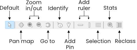
- Default: Lets you click on intractable elements on the map.
- Pan: Allows you to drag the map around by holding down the left mouse button.
- Zoom in: Zoom the map in one level.
- Zoom out: Zoom the map out one level.
- Go to: Displays to Go to tool, which is used to re-center the map to a specified latitude/longitude.
- Identify: Display a utility window that contains information about the clicked point. For example, if there are multiple overlapping raster layers, the window will display the value for each of the layers at that point.
- Add pin: The Add pin tool lets you add pins on the map. Layer values for each pin location are displayed in the Pin Values Panel, which is displayed when the tool is first clicked.
- Ruler (lat, lng): Places a line on the map when clicked. Clicking on an existing ruler will delete it.

- Reclass: Displays the Reclass tool for the selected layer.
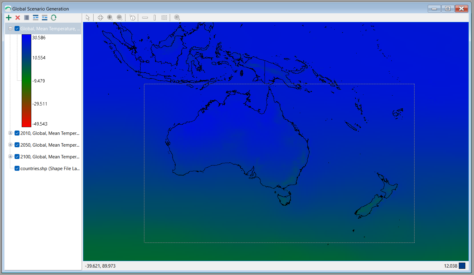
- Selection: The Selection tool allows you to drag a selection on an area of the map. This can be used to:
- Copy an area of the map
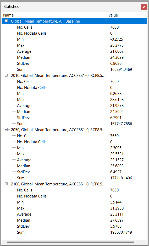
- Get Statistics for an area of the map
- Statistics: The Statistics button displays some statistical values for each raster layer on the map. If there is no active selection, it will display information for the entire layer.