Spatial data set
- Load or generate a Raster data set into a Map window
- Selected a raster layer in the Layers List.
- Right click it and select Spatial data set:
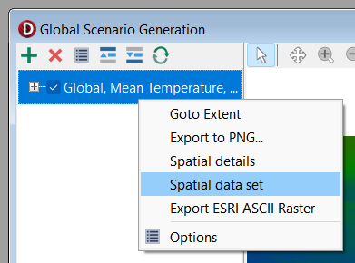
- A utility window showing the data, as a grid of values, will be displayed.
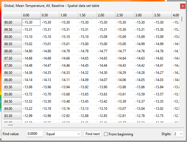
The Find Value panel allows you to find a cell that matches a certain condition. Conditions include: Equal, Not equal, Less than, Less than or equal, Greater than and Greater than or equal. Specify a condition and click the Find next button. If a matching cell is found it will be selected within the table.
The Digits drop down can be used to specify how many decimal places to show for values in the table.
Values of "-9999" represent no-data values.
Right clicking the table shows a menu that allows for selecting and copying values.